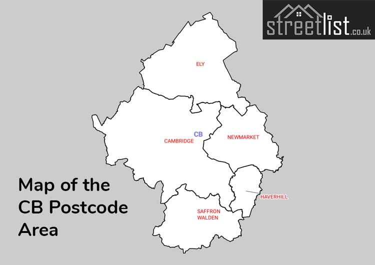
The CB postcode area, also known as the Cambridge postcode area, is a group of sixteen postcode districts in the east of England, within five post towns. These cover much of south and east Cambridgeshire (including Cambridge and Ely), plus parts of west Suffolk (including Newmarket and Haverhill) and north-west Essex (including Saffron Walden), and a very small part of Norfolk.
Districts CB21 to CB25 were formed in September 2006 from the parts of districts CB1 to CB5 lying outside of the city of Cambridge.
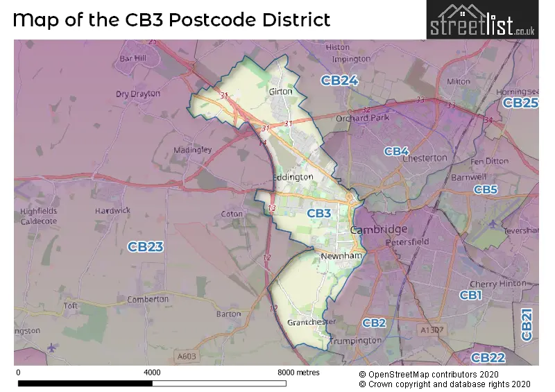
Coverage
The approximate coverage of the postcode districts:
Map
See also
- List of postcode areas in the United Kingdom
- Postcode Address File
References
External links
- Cambridge Postcode Checker [1]
- Royal Mail's Postcode Address File
- A quick introduction to Royal Mail's Postcode Address File (PAF)